


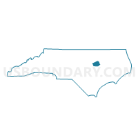
Voting District PROL, Wilson County, North Carolina
About
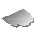
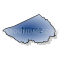
Outline

Summary
| Unique Area Identifier | 641864 |
| Name | Voting District PROL |
| County | Wilson County |
| State | North Carolina |
| Area (square miles) | 51.30 |
| Land Area (square miles) | 49.05 |
| Water Area (square miles) | 2.25 |
| % of Land Area | 95.62 |
| % of Water Area | 4.38 |
| Latitude of the Internal Point | 35.73188100 |
| Longtitude of the Internal Point | -78.06793810 |
Maps


Graphs
Select a template below for downloading or customizing gragh for Voting District PROL, Wilson County, North Carolina


Neighbors
Neighoring Voting District (by Name) Neighboring Voting District on the Map
- Voting District 0001, Nash County, NC
- Voting District 0005, Nash County, NC
- Voting District PR20, Johnston County, NC
- Voting District PRBL, Wilson County, NC
- Voting District PRCR, Wilson County, NC
- Voting District PRSP, Wilson County, NC
- Voting District PRTA, Wilson County, NC
- Voting District PRWJ, Wilson County, NC
Top 10 Neighboring County Subdivision (by Population) Neighboring County Subdivision on the Map
- Wilson township, Wilson County, NC (42,775)
- Taylors township, Wilson County, NC (9,001)
- O'Neals township, Johnston County, NC (8,868)
- Old Fields township, Wilson County, NC (5,379)
- Bailey township, Nash County, NC (4,397)
- Black Creek township, Wilson County, NC (4,087)
- Cross Roads township, Wilson County, NC (3,896)
- Dry Wells township, Nash County, NC (3,702)
- Springhill township, Wilson County, NC (3,131)
Top 10 Neighboring Place (by Population) Neighboring Place on the Map
Top 10 Neighboring Unified School District (by Population) Neighboring Unified School District on the Map
- Johnston County Schools, NC (168,878)
- Nash-Rocky Mount Schools, NC (106,786)
- Wilson County Schools, NC (81,234)
Top 10 Neighboring State Legislative District Lower Chamber (by Population) Neighboring State Legislative District Lower Chamber on the Map
- State House District 26, NC (95,937)
- State House District 23, NC (75,657)
- State House District 25, NC (73,935)
Top 10 Neighboring State Legislative District Upper Chamber (by Population) Neighboring State Legislative District Upper Chamber on the Map
Top 10 Neighboring 111th Congressional District (by Population) Neighboring 111th Congressional District on the Map
Top 10 Neighboring Census Tract (by Population) Neighboring Census Tract on the Map
- Census Tract 14, Wilson County, NC (8,885)
- Census Tract 4, Wilson County, NC (8,028)
- Census Tract 115, Nash County, NC (6,939)
- Census Tract 402.01, Johnston County, NC (6,342)
- Census Tract 15, Wilson County, NC (5,495)
- Census Tract 113, Nash County, NC (4,961)
- Census Tract 114, Nash County, NC (4,304)
- Census Tract 17, Wilson County, NC (4,283)
- Census Tract 9, Wilson County, NC (3,716)
- Census Tract 16, Wilson County, NC (3,108)
Top 10 Neighboring 5-Digit ZIP Code Tabulation Area (by Population) Neighboring 5-Digit ZIP Code Tabulation Area on the Map
- 27893, NC (39,723)
- 27896, NC (20,130)
- 27542, NC (9,133)
- 27557, NC (7,509)
- 27807, NC (6,629)
- 27851, NC (5,268)
- 27880, NC (3,304)